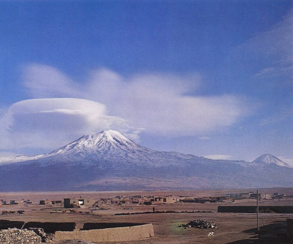
 | Lenticular clouds rise above Ararat seen from the southwest, with the cone of Little Ararat at far right (photo courtesy of Turkish Tourism Information Office) <click to enlarge> |
Ararat
(Agri Dagi)
16945 ft (5165 m) Highest point in Turkey . |
||||
| Major Peaks: |
| ||||
| Location: | Eastern Turkey, near Armenia and Iran borders | ||||
| Lat / Long: | 39.7° N, 44.3° E | ||||
| Volcanic Type: | Stratovolcano complex | ||||
| Volcanic Status: | Active, minor eruption 1840? | ||||
| First Ascent: | Dr. Friedrich Parrot, Khachatur Abovian, Alexei Sdrovenko, Matvei Chalpanof, Ovannes Aivassian, and Murat Pogossian, 1829 | ||||
| First Ski Descent: | |||||
| Skiable Vertical: | well over 8000 ft (2500 m), perhaps over 11000 ft (3400 m) is possible | ||||
|
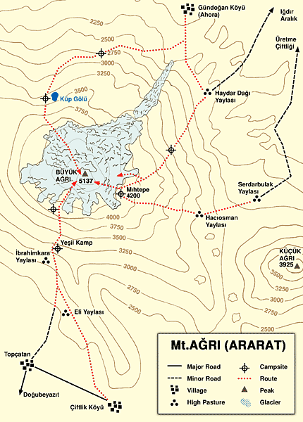
Ararat is one of the most famous mountains in the world, not because of its stature as one of the
world's great stratovolcanoes but because it is the legendary resting place of Noah's Ark. Yet
Ararat is truly a magnificent mountain, with two separate cones which dominate the view throughout
the northeastern part of Turkey and also much of Armenia and portions of northwestern Iran. The
main cone of Ararat (Great Ararat, or Buyuk Agri Dagi in Turkish) supports a large summit icecap
with an area of about 4 square miles (10 sq km), plus a single large valley glacier within the
Ahora Gorge, a deep gash in the north face formed by an ancient landslide. The almost perfectly
symmetrical cone of Little Ararat (Kucuk Agri Dagi in Turkish) is a sizable stratovolcano in its
own right, rising more than 4000 ft (1200 m) above the saddle separating from its big brother about
7 miles (11 km) to the WNW. Winter snows often accumulate to well below this saddle, and even
sometimes as low as Dogubayazit at 5600 ft (1700 m), providing numerous possibilities for
spectacular and lengthy ski descents. Unfortunately, Ararat's location in a sensitive border area
makes it the only Turkish volcano with a lot of bureaucratic red tape for climbing or skiing trips
(in fact the Iranian border crosses the eastern slopes of Little Ararat at an elevation of over
6000 ft / 1800 m).
|
|||